Journey’s end


On the Hercules flight that brought us up here from NY, back in late April, Chris belted through my ear plugs, “I GOT IT, I GOT A NAME FOR THE TRAVERSE…”


IMG_0581

The 2400 mile, 4000 kilometer, S.A.G.E. Traverse

Amid all the preparations, construction of electrical components, route planning, gear acquisition, conference calling, emailing, etc. we hadn’t yet settled on a title to call this whole affair.

In what would turn out to be our patented style as a field team, the best work came spontaneously, off-the-cuff, and in the moment the demand arrived… Later that evening, after landing in Kangerlussuaq, Chris published this WordPress sight with the name, SAGE.

DSCN7650

Three days ago, with Summit Station in sight, Chris draws our route on the patch Mike sewed (with needle and suture from the Medical Kit!)


Science projects, field campaigns, and research efforts ALWAYS have an acronym, ALWAYS have a round table meeting to carefully choose it, and ALWAYS have it in place well in advance for promotion, funding, and outreach. SAGE on the other hand, entirely homespun, hand created, and rather stubbornly hard fought, barely snuck under the wire with ours! Comically, with a name that would suggest a rather OPPOSITE scenario.


To our credit though, and presented for your amusement, is the one flurry of potential acronyms that Zoe, Nate, Chris, and I exchanged via e-mail way back in February (thinking that an appropriate one would surely take form, well in advance of departure). As Co-Principal Investigators, on this NSF Funded project, Zoe and Chris will publish papers with this acronym, be saying the name through microphones in front of conference room audiences, and have it feature prominently on their resumes… fertile ground for a hilarious exchange of ridiculous garbage suggestions (though a couple were quite earnest and nerdy)! I have sadly edited out the ones that really had us rolling around, but the PG versions will at least bring a smile. We would love any fun acronyms that you could create, ex. post facto, for the traverse!         

“RaBIIS” Radiative Balance across Interior Ice Sheets

“AbSEnT”   Absorption of Shortwave Energy in Traverse

“ABCDEFGH” About Black Carbon Demolishing Ephemeral Firn in Greenland, Hollah

“SIN” Sun and Ice in the North

“ABSTRACT” Absorption of Snow Traverse Researching Albedo and black Carbon Together

“TAG ALONG” Traverse Across Greenland for ALbedo Observations oN Greenland

“SAVAGE” Spectral Albedo Variability Across northern Greenland Expedition

“ICING” Integrated Climate study of Interior Northern Greenland

“MANHAUL” Measurement of Albedo in Northern HAlf of greenland Unsupported Largely

“CANNIBAL” Counter 1972 ANdeaN Incident via Better AnaLysis of risk

“FUELDROP” Firn Unification and ELemental carbon Devastation Research On snowPack

and my personal favorite (a suggestion from Nate):

SASQUATCH – Surface Albedo Snow Chemistry QUantified Along Traverse Coordinates, Hopefully


IMG_0619

Nate, decked out for DUFISSS, after digging the final pit of the traverse

Nate really was a Sasquatch as it turned out, by summing up the number and dimension of snow pits that he dug, we figure the guy actually moved a little over 107 metric tons (235,400 lbs) of snow!

DSC_0269

How do you block that?!

IMG_0609

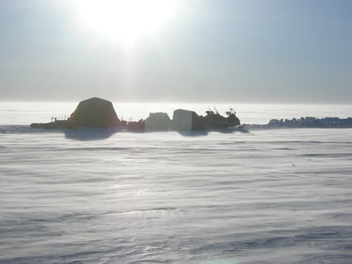
On the very edge of the horizon, our first view of the journey’s end, Summit Station.

The trip was incredible for us. We laughed, worked, drove, slept, and snacked (!) harder than most would do in a years time. I was asked, when we returned, what it felt like to be exposed to the Greenland elements for such a long duration. The first thing that came to mind was, “It was like those welter weight Puerto Rican boxing matches you might catch on TV… nobody blocking, each just connecting a blurring barrage of punches. Us VS the Greenland Ice Sheet. The only reason we’re still standing is that the bell rang, because Lord know’s that Greenland’s not giving up that belt”. Another couple of days and who knows what piece of gear might have given up the ghost, not to mention, “no meat, no manpower!”. We came in at just about the perfect time on all accounts!

IMG_0613

Nate, breaking the stow for one last time. This sled of empty fuel cans was warmly referred to as the “Crabber” for it’s resemblance to the burgeoning fully loaded Alaskan workhorse.

It’s been amazing to return here to Summit Station. The crew gave us a royal welcome home. Ken, the Station Manager, met us out on the snow and immediately jumped in the CAT 933 and dug a snow locker for our samples (at 8:30 PM). Inside the Big House, Trudy had set aside two full pizzas for our dinner, and a whole gang of friends came out to see us in. This is truly a wonderful group of people up here.


We have had a very difficult time being inside heated buildings! Down to t-shirts, bare feet, and with our pants rolled up we still can’t stop sweating! After these weeks and weeks of outdoor living and working we have become rather sasquatchy all around, entirely unfit for being near heaters!

With all the gear packed onto Air force pallets, our three snow machines parked, and the empty sleds piled up like Dixie cups, the Traverse has truly come to a close.

If you have ever done something grand, of wild proportions, of a scale that’s great enough where the start and the finish seem to have a lifetime between them- then you know the feeling the three of us share today.

DSC_0485

Nate and Chris, in the ice fields above Melville Bay, before our long run north

And, if you ever find yourself drumming up plans to make a passage, attempt a crossing, or bid for a remote ascent- find men or women like Nate and Chris to fill out your team.

Steady, sound, inventive, adaptable, inspiring, and quick to laugh. These two never stopped working, never stopped making me smile, never stopped impressing me with their capabilities.

IMG_0587

Chris’s view of Nate and I. He watched for our safety from this vantage point from the moment we started to the moment we parked the machines

IMG_0074

The daily scene with Chris: working/laughing until some absurd hour of the pre-dawn

Twins

Nate harnessed up to man-haul the kitchen door off it’s hinges, something which clearly has me beside myself (we’re age 3 here)

An amazing dynamic can arise when certain personalities combine and set out from the beaten path. Some people truly rise and lead. I had two of them. Two Doctors who fill their days with a hundred other identities and talents, who are spectacularly funny, and a joy to spend time with.


I raise a glass to you Chris and Nate, you have spirits like a chip of ice: bright, hard, and pure. I would go to the very ends with you guys, just say the word. Thanks for the journey of a lifetime.


Winchester

Written by Chris Polashenski

WWII speak for returning totally out of ammunition. And though our ammunition is sample bottles, gasoline, oil, food, and we’re certainly coming in winchester.  As we roll in, remaining in our stores is a frighteningly small amount of gasoline (a bit under 2 gallons, collectively, in the tanks of the machines), two stroke oil (1 gallon), chocolate (5 bars), meat (none), AA batteries (none), generator spare parts (none), snowmachine spark plugs (2), empty sample bottles for black carbon (20), empty sample bottles for ions (none), and dimethyl pthalate jugs (3). Ohh yeah, and clean clothes – none of those either. We probably smell kinda bad – but we can’t tell!

Comparing 6 weeks ago when we arrived at Summit with 650 gallons of gasoline, 20 gallons of 2 stroke oil, 83 pounds of chocolate bars, 150 pounds of sausage and meat, 200 AA batteries, a plethora of repair parts for machines, 600 sample bottles for black carbon, 500 sample bottles for ions, and 18 jugs of Di-methyl phthalate, we’re definitely lightened up seriously. The only things we are returning with great surpluses of are those two things an expedition positively could not run without. Coffee and toilet paper! No coffee, no worky. We won’t get into the toilet paper.

Our non-consumable gear has also reached the point where it’s time to return to base where proper repairs can be made. While I’m proud of our ability to keep almost all of our equipment running throughout this expedition, I can’t say I’m entirely proud of the aesthetic we’ve created in our gear. Almost all of the cords to our instruments have been broken, soldered, rebroken, taped, and glued back together. Our generator leaks oil out the re-used gaskets from our repair. Our stove leaks propane out its side, which periodically ignites into an exciting third burner.  Our DGPS has gone on vacation already, as has one of our dataloggers. Mike’s snowmachine has a few “aftermarket” parts, including a side panel made out of spare sled material. Our tent and clothes have a few more patches and poorly placed stitches than when we left, but need more. Boxes are starting to periscope up through some of our sled covers, and our ratchet straps, once a formidable army, are a decimated, frayed, and ragtag lot. Luckily we’ve managed to get just about every sample and measurement we set out to take. Worn gear, consumed supplies, and tired bodies are a small price for such a resounding success!

While we are certainly sad to be leaving the rhythm of long drives across this amazing  ce sheet, pit digging, late night sampling, and even later overeating we’ve gotten ourselves into, it’s clear that our trip is coming to an end. We’ve all got wonderful ladies to go home to, who’ve been holding down the forts amazingly well. Still, there’s probably some chores we’re a bit behind on. I’m slated to hay on the farm in Vermont and figure the first field will be getting knocked down as I pull in. Mike’s moving out of his house in Fairbanks and headed to Homer, AK to his day job as captain of the research vessel Kittewake, and Nate is off to Colorado to prep lectures for his fall classes.

For the next couple days we’ve got a lot of work to do – work we’re well practiced at. All our samples and science gear needs to be packed up on a pallet and ratcheted down. This is something we’ve done daily – only now we’ll be making the loads on an air force pallet rather than on sled trains. Then we’ll do a VERY thorough pit here at Summit to collect a wide array of inter-comparison samples which we will use to validate and calibrate the lighter sampling techniques we were able to take along on the traverse. Several of the more traditional methods for measuring black carbon will be employed – these require melting 10 liters of snow and filtering them, compared to placing 100cc’s of snow into a bottle and bringing it home. More about this tomorrow. For now, we understand there is a leftover’s  fridge in a heated building here at Summit – we may need to investigate.

DUFISSS!

Written by Nate Stewart

One of our daily goals up here on the ice sheet is to measure and track changes in the specific surface area of snow, or SSA. Specific surface area is the amount of surface area on the grains of snow in a unit volume of snow.  In general, larger grains have less surface area per unit volume than smaller ones, but the complexity of the snow grain shape is important too. A round snow grain has much less surface area than a classic dendritic snowflake of similar size. In addition to surface albedo, snow chemistry, and snow density, we believe that greater understanding of SSA and its variation across the ice sheet is critical to understanding the extraordinary and unexpected melt that occurred up here last year.

pper 16 cm of a 290 cm pit wall showing discernable variation in 2013 wind slab snowpack features.

Upper 16 cm of a 290 cm pit wall showing discernable variation in 2013 wind slab snowpack features.

Snow is incredibly effective at scattering and absorbing sunlight and, as a result, is critical to the energy budget of the Earth. The Greenland ice sheet is, in effect, a massive natural solar reflector. The ability of the ice sheet to reflect light is determined, among other things, by the size and the specific surface area of the very snow grains that make it up. The snow grains themselves are highly variable, ranging from rock solid melt-freeze layers to the light and fluffy dendritic snow crystals we attempt to emulate using paper and scissors. Unlike the elaborate branching dendrites characterized by their large SSA values, melt freeze layers have relatively small SSA and absorb much more solar radiation. Despite the importance of SSA to the Earth’s climate, very little is known about how SSA varies and to what degree this matters to the climate system itself. This is the very reason we are towing along a DUFISSS with us as we traverse the ice sheet.

DUFISSS, calibrated and ever-ready to illuminate a fresh snow sample.

DUFISSS, calibrated and ever-ready to illuminate a fresh snow sample.

DUFISSS is a special instrument developed by our friend and colleague Florent Domine, a snow scientist from Takuvik, the Arctic research group at the University of Laval in Quebec. DUFISSS (DUal Frequency Integrating Sphere for Snow SSA measurement) measures SSA using a novel optical system. The machine itself looks like a formidable little box with feet. Inside the box is an open sphere 15 cm in diameter situated above an opening just large enough for a hockey puck-sized snow sample. Once a snow sample is placed beneath the sphere it is illuminated from above by a 1310 nanometer beam blasting down from a laser diode. Reflected back is  detectable flux of photons that bounce back into the sphere and are collected by a photodiode that converts light intensity into voltage. We are then able to read a voltage value on an LCD screen and use it to calculate SSA. The photodiode “collector” is calibrated using a set of known calibration standards each time we use DUFISSS in the field. They range from 5% reflectance, which looks as dark as soot, to 99% reflectance, which looks as bright as the brightest white dress shirt you could possibly imagine. Once calibrated, the SSA snow sampling method is quick and fun. We core the snow surface and the snow pack at 3 cm intervals using a stainless steel core the size of a small drinking glass. The core itself is lifted from the pit wall using a spatula and then injected into a hollow hockey puck-sized cup before it placement beneath DUFISSSS. The technique minimizes snow crystal deformation and solar heat-up during sampling – two insidious sources of error when sampling snow – and mobilizes two quintessential Canadian institutions, the spatula and hockey.

lectance calibration (on left) juxtaposed with a snow sample from tonight's western Greenland site.

The 99% reflectance calibration (on left) juxtaposed with a snow sample from tonight’s western Greenland site.

Historically, dogs have played a critical role in maintaining the morale of men on polar expeditions. Despite heinous weather, suboptimal sleeping conditions, and brutally hard work, their unconditional loyalty and ever-readiness to play has forever been a welcome source of lightheartedness and sincere companionship for weary men. In the notable absence of dogs on the SAGE traverse, DUFISSS has affectionately and faithfully filled this role for the team.

After hours of hard work in the pit DUFISSS is always up for a little playing and cuddling.

After hours of hard work in the pit DUFISSS is always up for a little playing and cuddling.

Tremendous thanks to Florent and his colleagues for their technical innovation and development of a polar field-capable SSA instrument. DUFISSS is a marvelous alternative to a number of vastly more time and material expensive pre-existing techniques (think vacuum containers, massive amounts of liquid nitrogen, x-ray machines, and methane gas . . . each of which would be dangerous, smelly, or downright catastrophic to move across a cold, remote, high altitude roller coaster of an ice sheet via snow machine and sled ).

Tomorrow night we call upon DUFISSS for the second-to-last time on our journey across Greenland. We are certain he’ll stand tall and laser diode the SSA out of anything we place beneath it.

Southbound Train and an Arctic Gem

Written by Mike Stewart

There is something elemental, basic to our nature, about turning for home. Even when the ship is still weeks from landfall, 100’s of miles from arrival, the simple fact that the bow is pointing that way shifts something deep in one’s chest.

And though we are over 400 miles from Summit Station, with days ahead of science and sampling, there is a notion of ease with the change of heading. In an endeavor such as this, one’s mind never stops measuring and re-measuring, balancing, and weighing out the variables. It’s a hamster wheel that just keeps rattling away up there, even when the sun is burning down and the machine is charging along perfectly across the powder,  that tireless vermin of LOGISTICS keeps rolling along on it’s squeaky wheel:
1.      Consumables: how much gas, oil, propane, sample bottles, AA batteries, generator spark plugs (none left!), butter, coffee, meat, etc, do we need if we add one more science station?
2.      Weather: can we make efficient speed against the headwind or do we wait, use less fuel, and lose time?
3.      Exposure: when depending on all this delicate machinery in a harsh environment, it’s only a matter of time before components start failing beyond our ability to repair them. When do you decide to limit your exposure, simplify your regime, but sacrifice parts of your mission in doing so?
4.      Etc, etc.

It’s a space that some thrive in (and some avoid at all costs!) this balancing of controllable and uncontrollable parts.  It’s the key to a successful venture, the key to astute management and savvy leadership.

Chris securing the science load

Chris securing the science load

It’s been said that this innate ability, of all traits, was Shackleton’s greatest strength. Anyone who has worn the mantle of responsibility, particularly when other people’s safety is involved, knows the complexity of operating among the moving parts. We have worked over our formula intently. Tomorrow we reach our fuel and oil cache. We’ll load up the entirety of our freight for the first time in the expedition (up until this point it has only been moved and stowed in parcels) and we will finish the last of our work.

Camp, heading back to Summit.

Camp, heading back to Summit.

That hamster can start working a different kind of math. The steady decline of necessary items becomes streamlining and lightening, instead of nail-biting and frightening! So our spirits are high, and a clear feeling of momentum surrounds us. When we struck camp this morning, we decided to celebrate with an adventure to an incredibly unique place on our way to the cache.

Just 75 miles from our location is the base of operations for the NEEM Project (North Greenland Eemian Ice Drilling Station).  This crew from this camp successfully drilled ice core samples through the ENTIRE thickness of the ice sheet, a depth of 2,537.36 meters! After five years of steady work, undertaken by a consortium of scientists from 14 nations, the NEEM Team has extracted ice which can give us a detailed understanding of the Earth’s climate from the Eemian interglacial period (130,000-115,000 years ago). This is of particular interest because the average global temperature was slightly warmer than it is now, and may help us to understand how our modern earth may respond to climate change.  The project was lead by Chief Scientist Dorthe Dahl-Jensen (see go.nature.com/tU35ut for more), and the station built and run by the Danish. We have heard nothing but wonderful things about the project, the people, and the place.

NEEM station, packed up and ready for the move to the next deep driling site

The famous NEEM station dome, a structure designed to minimize drifting around the station. Everything here is packed up and waiting for the move to the next deep drilling site.

Nate working in our science pit and camp 200 m away from the NEEM site.

Nate working in our science pit and camp 200 m away from the NEEM site.


And it turns out to be amazing! We arrived and wandered around shaking our heads and smiling. What a fun and creative way to design an Arctic shelter. If only staff or crew were here to show us around! We decided to celebrate by bringing in our little camp kitchen and having our dinner in the gorgeous common room of the station.

Way back in March Chris assigned us to each bring along a special surprise dinner for the trip, which could be brought out at just the right occasion. A finer setting couldn’t have been asked for, and Chris took the evening to prepare his.

Chris working in the NEEM kitchen to prepare his special meal.

Chris working in the NEEM kitchen to prepare his special meal.

What a feast! Venison steaks from his Vermont hunt, Polish Pirogies from his Pennsylvania hometown, and wild Salmon from Cook Inlet!

Chris cooking

Chris cooking, luxuriating to be cooking outside of the tent, and not on action packers.

Chris's special surprise meal (one step up from the mac&cheese)

Chris’s special surprise meal (one step up from the mac&cheese?)

We’d like to extend our warmest gratitude to the station manager, science staff, and the whole drill crew of NEEM. You have made an incredible camp here with such a special energy to it. Thanks for your warmth and hospitality, it’s an honor to visit the site of such a successful field campaign. We hope some of your triumph can rub off on our little venture! If you are ever visiting Alaska, we’d love to cook a similar dinner for you.  Thanks for the shelter and inspiration, Skol!

Ultima Thule, Polar Bear, and Generator Repairs

Written by Chris Polashenski

The Farthest North. A goal of such explorers as Nansen and Perry. We certainly won’t be reaching the pole on this trip, but pretty far north just the same. Today was our last day driving that way and a magical day it was. We started the day by carefully re-calculating our fuel and two stroke oil budgets this morning and determined that a 100 mile day, as planned, would be pushing our fuel just a bit too close for comfort. Seventy five miles it would be.


80N, 50W A big convergence

(80N, 50W) A big convergence

Inspired by Matthew Sturm’s book “Finding the Arctic”, which was mandatory reading for all on this trip, we’ve hit a couple ‘convergences’ – places where whole degrees of latitude and longitude intersect. An entirely contrived game that only silly humans toting GPS’s would consider fun, the basic idea is to be the first person to have ever stood exactly at a particular convergence. At first we thought that by bagging a few that happened to lie very close to our route we were really accomplishing something unique – until we did the sobering math to figure out exactly how many convergences there are on earth. 360 degrees of longitude, intersecting 180 degrees of latitude. 360 X 180 = 64800. Ohh well – we still think it’s unique! Examining our intended bearing to the northeast along with our new range constraint this morning, I quickly realized that the intersection of 80N and 50W was 73.5 miles away, in almost exactly the correct bearing. A multiple of ten convergence –there’s only 648 of those! Nerd excitement rang out and off we went.


Evidence of an abrupt stop

Evidence of an abrupt stop

Driving along was rough going. We are driving across the prevailing wind, which appears to be catabatics running down the mighty Petermann Glacier toward the Northwest. The sastrugi are large and unpredictable with occasional 2-3 foot high ‘whalebacks’ that are rock hard and send you and your sled loads for a jangle. The terrain was beautiful though, and as we picked along at 35 km/hr we dropped in an out of small broad valleys that told us the ice was all feeding into Petermann, and probably grinding up some mountains thousands of feet below along the way.  Then, all of a sudden, there it was. Unmistakeable. In a maneuver carefully practiced from looking for animal tracks from any number of conveyances over the years, I slammed on the brakes on my machine – the first time I’ve touched them all trip – backing up my 3 sleds behind me and careened to a sliding sideways stop. One hundred forty five miles from the nearest water at the tongue of the Petermann Glacier in Nares Strait, I’d just crossed a polar bear track, followed closely by an arctic fox. Mike and Nate piled into the heap behind me cartoon-style, gawked, shouted disbelief, then wandered silently along the track in awe of the polar pair we’d intersected in this vast desert. We’ve all seen and spent time with polar bears before, and we even have a rifle along for bear protection as mandated by our permit from the Greenlandic government, but we never ever expected to see any sign of one up here.  The temptation to take off on the track was almost irresistible, but it was a day or two old and we haven’t any extra fuel. He was headed toward NEEM though, so maybe we’ll see him in the next couple days. Reluctantly we saddled back up and headed off without pursuit, spending the next 30 miles tricking ourselves into thinking every disturbed snow grain was another track, every shining sastrugi an arctic fox. Naturally none were to be found. You can’t force magic.

The Polar Pair...Polar Bear and Fox

Polar Bear and Fox, The Polar Pair

In camp the magic seemed to have worn off. The sleds had taken a serious beating during the day’s drive and, more than usual, opening boxes to get gear out meant repairs. 4 samples had hopped ship somewhere along the way too. Out of 1200, this isn’t a huge loss, but stinging just the same. The biggest problem, however, was that our generator had ceased up. Nothing we could do could spin it, and it’s a critical piece of the operation – within a couple days no generator would mean no drill, computer, sat phone, cameras, spectroradiometers, thawed dimethyl phthalate for snow preservation and more. We do have the ability to generate some power off the snow machine alternators, but losing the generator puts us in a very different mode. Unacceptable.

Cracking the crankcase

Cracking the crankcase

A ceased engine was more than we were expecting to have to deal with. Spark plugs sure. Adding oil, no problem. Even cleaning and rebuilding the carburetor, but not being able to turn the crankshaft – no that’s bad. Mike and I rolled up our sleeves though and dug in. Generally amazingly reliable, the Honda generator is not made to be taken apart – but something, and we were determined to find out what, was jammed in her piston, probably a valve. Odds were laid for the likelihood of success (35% from Chris, 0% from Mike) and work began. Two and a half hours later she was completely cracked open.  Some finagling with the valves and a few knocks on the crankshaft bearings and she miraculously came loose. Then the great puzzle of putting her back together. Another 2 hours.  Nate basically did our entire science station himself – but by gosh as I sit here and type this 600 miles from the North Pole and 715 miles (by our route) from Summit station, our generator is purring like a cat and we’re some pretty smug, tired, greasy campers.

Getting to the heart of the matter.

Getting to the heart of the matter.


Mileage, Old Snow, and ?!?!People!?!?

Written by Chris Polashenski

Since our last post from site 1A-20, which is on the southern, ocean-ward limb of the peninsula we’ve been working on, we’ve traveled North by Northeast over the top of the divide and into ice that flows toward Nares’ strait and the Arctic Ocean. As soon as we crossed the divide, the character of the snow changed. We left the high winds and beautiful dune and barchans formations behind in a matter of minutes and entered a flat land gleaming with surface hoar frost  – clearly the storm had never been on this side of the divide. Stopping in at camp and pitching the tent gave our next sign of change. At 20cm, the tent stakes hit something hard- last summer’s melt layer. In 100 miles of driving we’d crossed from 160+ cm of annual accumulation to 22cm. This is truly a desert.

Drilling in the pit

Drilling in the pit

With such low accumulation, our 2 meter deep pit took us back approximately 9 years, possibly 10. The uncertainty arising from the fact that it is difficult to estimate how much snow melted away last year – at least one year’s worth, but maybe more. All of the melt re-froze in deeper layers, so we could examine how much there was in the pit wall, but more may have been beneath the bottom of our pit. Drilling in for our 10 meter temperature (we actually make a 13 meter hole) took us back around 60 years. Pretty cool.

Though we’re still headed north, and 600 miles or so from Summit station, we’re starting to think about our exit strategy. Our plane home leaves on June 6th, and we need to be back at Summit before June 4th to get packed out. This part of the traverse had always been a bit fuzzy in the plans. You’ll see if you look at our planned route only 4 waypoints set for our return route. The primary science objectives were all along the GriT traverse route that we’ve already completed. Since we had to drive back, however, and since we were already so far out, several important secondary goals were on the radar. First is to get deep into the low accumulation zone on the North side of this divide to sample for black carbon. We are very curious whether black carbon deposition is predominantly a dry (without precipitation, just settling out) or wet process (falling entrained in snow). The huge precipitation gradient we’ve crossed provides a nice natural experiment for checking on this. Second, we wanted to validate what the satellites had indicated for melt extent and severity last year. A couple areas of interest were pointed out by our friend and collaborator Son Nghiem here in the North, and on  the Eastern side of the ice sheet down toward Summit. Finally, at least on the abbreviated list, our friends in Joe McConnell’s research group are drilling a firn core out at Tunu camp in far northeastern Greenland. Dragging our ground penetrating radar in to their site could connect what we’ve seen all along to a very detailed analysis, providing us a better idea what we’ve seen, and them a better idea of how spatially representative their core is.

Alas, now that the days are numbered and our fuel jugs are dwindling, we’ve had to make our plans for which secondary objectives to hit, and which to abandon. We want to do it all, but with 100 mile driving days for the next week, the plans we’ve made will already pack in about as much excitement as we can handle.
Or so we thought.

Plane in the distance

Plane in the distance

Today while driving along, somewhat bleary eyed on smooth terrain at about 40 miles into our 106 mile run I caught something strange in the distance. Distances being hard to estimate, first it looked like a bird, but as it came closer to focus it was clear it was much too far away. Maybe a flock of geese? Mmm.  geese. Nope that’s not right either. I stopped and whipped out the binoculars. It was a twin otter (a highly capable 2 propeller bush aircraft). Weird. We’re a long way from anything. And it had just dropped in out of the clouds and was making tight circles, about 3 miles down our route. Are they landing to meet up with us? We drove on toward it at top speed as it set down and landed. Who was this? Did someone decide to bring us fuel? (we’d like that). Running in we could see a couple figures and a weather station. We had happened by pure chance upon Koni Steffen, a renowned researcher from Switzerland, and formerly CIRES in Boulder, Colorado as he’d flown in with a group to maintain a weather station in the network we’re adding to on this trip. We hadn’t even taken the coordinates of the weather station in advance, so had no idea we were driving right by it, had the plane not come out of the sky. Koni and I had emailed back and forth when we wrote the proposal for this work to the National Science Foundation, but never met in person. What a way to meet! Handshakes, smiles, and amazement all around, and an exchange of Swiss chocolate (Koni’s group) for caribou jerky (from us) ensued. The Icelandic pilots, David and Kiddi, one of whom had never driven a snowmachine, asked to take the sleds for a spin. Some hilarious sub-standard driving ensued. We joked that we should get to take the plane for a spin in exchange! As a pretty good consolation we got a few cokes and a couple Icelandic yogurts (best yogurt on earth!). After half an hour or 45 minutes of chatting with the first people we’d seen in weeks, and receiving an open invitation to stop in at the Danish NEEM camp on our return south in a few days, we parted ways with our unexpectedly met colleagues and continued off to our evening’s camp 60 miles to the North.

SAGE meets Nolandair

SAGE meets Nolandair

Meeting of the groups

Meeting of the groups

Pilots give ground navigation a try

Pilots give ground navigation a try

Icelandic Yogurt!!

Icelandic Yogurt!!

Tonight’s pit was a whopper – only 18 cm of accumulation, but the melt hit this area hard. Several layers of ice a few inches thick each made for a 4 hour dig. Now at 3 am we’re all ready for some hard sleep after an exciting day. Tomorrow we’ll make our furthest North camp – Ultima Thule!

Koni's Station

Koni’s Station

On to the next!

On to the next!

The Wild West

Written by Chris Polashenski

Yesterday we arrived a rather momentous site, in a somewhat anticlimactic manner. After running fast and smooth for a hundred miles or so, and catching glimpses of the coastal mountain range being ducted to us by atmospheric inversions that bent light from beyond straight-line visible range, we expected to arrive at our final site west, closest to the edge of the ice sheet whooping, hollering, blaring fast, and with mountains all around. As we got closer we began to see hills and valleys in the ice, and got ever more excited. Gradually at first, however, the surface began to get slightly rougher. Within several miles we were in HUGE sastrugi – a surface with waves of rock hard snow as much as 4 feet high. Our blaring 40mph run quickly dropped to a 10-15 mph weaving-dodging maneuver as we punished our kidneys and our loads over some truly uncomfortable terrain and delicately tried to find a better path forward. The weather was warming too, in the 20’s F and I was worried about melt as we burned a considerable amount of our precious fuel driving around hummocks in low gear. No mountains either. As we arrived at the site, we realized that the increasing ice topography had us essentially driving in a trough with no view of anything but ice. The weather was a balmy -1C on the weather station’s first test, and with the dual threats of melt turning the place into a quagmire, and the possibility that whatever sort of storm could possibly have made the surface topography we were driving in might come back, we were not eager to spend a great deal of time at the site. Reading Carl Benson’s report of a June 12, 1954 storm very near the site which brought sustained 70mph winds only re-enforced our eagerness to depart.

Mountains 100 miles away, ducting to use in an inversion.

Mountains 100 miles away, ducting to use in an inversion.

Even rougher than the "cabbage," perhaps this is rutabaga.

Even rougher than the “cabbage,” perhaps this is rutabaga.

The rough ride punished more than our kidneys. We’re told that our bread crumb tracker – which shows our current position on the web is no longer transmitting – I’ll look into this tomorrow. A number of station components also ended up worse for wear and were higher priority in the current triage. This site was the place of our last station deployment and we were all excited to get this last “space trash”, as Mike calls our whirligigs and do-hickeys, unloaded. Carrying these 5 stations has added to our loads considerably – 850lb of batteries, 300 lb of tripods, two large boxes of sensors, a bale of solar panels and more, each component adding a few ratchet straps to our daily un-strapping and re-strapping routines. Fortunately, all of the damage (which included a shattered solar panel face, 2 broken connectors, a few abraded cables, and some sheared bolts) was field-repairable with our toolkit, some epoxy, duct tape, and solder in the rather sublime 20’s F temperatures and dead calm winds we had at this odd, and apparently usually stormy, place. We’re pleased to report that “Frankenstation” lives and is now sending data back hourly via Iridium, ready for the next storm or whatever it is that happens at site Benson 1-10.

Note the smash in the solar panel, repaired by epoxy and as good as new.

Note the smash in the solar panel, repaired by epoxy and as good as new.

Not pretty, but it works again.

Not pretty, but it works again.

Frankenstation Lives! And we ride.

Frankenstation Lives! And we ride.

Among other things, the five weather stations we’ve deployed will continue a measurement I take at each site – the surface albedo – all year long. Albedo is key to this project – how much sunlight the ice sheet reflects exerts enormous influence over how much melt occurs on the ice sheet, and by extension how much sea level rises. Collecting albedo alongside our measurements of grain size and black carbon will help us understand how large an effect each of these is having on light absorption during the snapshot in time when we visited each site, but maintaining these measurements will tell us about changes occurring after we depart. A measurement of albedo can be simply a sum of all the solar energy incoming and outgoing (an “all-wavelength” albedo). Or you can take a spectral albedo – measuring the fraction of incoming sunlight that is reflected wavelength by wavelength across the solar spectrum. These stations will be unique in that we’ll measure spectral albedo with them as well as all-wave albedo. The spectral albedo gives us quite a bit more information about the surface. Human eyes, for example, are spectral sensors and phenomenal ones at that. We can see and identify the range of wavelengths from roughly 400-700 nanometers. We just happened to call them colors – the colors of the rainbow from deep red to green to blue all fall in this range of wavelengths and being able to tell the different light spectra apart is quite useful. Knowing how much of each wavelength a surface reflects allows us to identify things  – for example, the red sled (gasoline) from the green sled (food!). Similarly knowing how much of each wavelength the surface of the ice sheet is reflecting tells us about what is changing the overall albedo. Snow grain size, for example, exerts quite a lot of influence on reflection of near-infrared light (light in the range from about 700-2500 nanometers wavelength, which is invisible to the human eye.) A drop in near infrared albedo observed by the stations , which we are already seeing at our current sun-glazed site, will tell us the grain size has changed after our departure.

This evening I got a little jaunty with our ASD spectral radiometer and decided to show off its capabilities a bit. Check out the attached plot of the spectral signature of the red sled, green sled, red fabric, blue cot, and our orange tent. Knowing that blue light is around 400 nm, green about 550, and red 650+ see if you can identify which spectra came from which item without looking at the key. Also note that the instrument can observe light from the ultraviolet (shorter wavelengths than we can see) to the near infrared (longer than we can see), which gives us even more information about a surface than the eye does. While it is difficult to tell the red fabric from the red plastic in the plot zoomed in to only visible wavelengths, they are easy to tell apart in the near infrared.

m_B 1A-20

Spectal signature of camp stuff in the visible range.

m_B 1A-20 2 r

Spectral signature of camp stuff in the UV to NIR range.

After finishing the station late last night, we packed up and headed out, to hit one last station that Carl Benson occupied some 60 years ago before we blaze our own (circuitous) path back to Summit. Carl had made a short southerly leg off his main traverse to verify that the accumulation rate on the south side of the peninsula we’ve driven west out was high all the way along, even though it drops off dramatically along the traverse route, which crosses over to the north, rain-shadow, side. We figured we could catch the southern tip of this leg along the return route. Leaving the station deployment site, however someone, who shall remain unnamed, appears to have made a modest navigational  ‘error’ to the south. The ‘error’ may have been carefully calculated as a celebratory measure to give us some more climactic and stunning views of coastal mountains and nunataks (mountains that emerge from the ice sheet). Staying well clear of crevasse zones still allowed us to get within good visual range of a number of magnificently remote mountains. Being just half an hour’s ride from some certainly tempted the peak bagger in each of us, but being separated by an unknown labyrinth of enormous crevasses kept us from any further navigational errors. The climb back up onto the ice sheet via an ice flow channel was absolutely stunning – the climb our trip -and back on smooth surfaces to open the snowmachines back up.

Nunatuk

Nunatuk

Hill climb back onto the high ice sheet.

Hill climb back onto the high ice sheet.

Here in camp at Benson 1A-20, the nunataks are fading out of view as the wind whips up to around 30 knots and suspends a nice little ground blizzard all around us to welcome us back to the ice sheet. We’ve finished our pit (160 cm of accumulation last year), sampled for carbon, taken spectral albedos, and snow casts, measured grain size, installed a 10 meter temperature string, and eaten 14,000 calories of food between us. Truly a magnificent couple of days. Tomorrow we head northeast to cross into the lowest accumulation zone of the ice sheet. We wonder what’s going on over there and have some questions we want to answer!

Amazing views

Amazing views.

The Foodfather part II

Written by Mike Stewart

One of the most unique aspects of the Age of Exploration is how well the men
journaled their experiences. You can easily recreate the list of gear they
brought, things they wished they’d have brought, and WHO they blamed for not
bringing it!

Wegener Snow Cave

Wegener’s men gathered in the snow cave at Eismitte, at the center of the Greenland Ice Sheet

Often times, an expedition had so many members writing that beautiful accounts of their daily way of life could be reconstructed, after-the-fact, in the form of novels. Classical examples being “Endurance”, “Mawson’s Will”, “90 degrees South”, or Nordenskjold’s  miraculous fiasco of the “Swedish Antarctic Expedition”.

Nansen's preparations alongside the FRAM, 1894. He was famous for his meticulous attention to details of readiness (from National Library of Norway)

Nansen’s preparations alongside the FRAM, 1894. He was famous for his meticulous attention to details of readiness (from the National Library of Norway).

Those of you who have read these pieces are well aware of how much food is mentioned! In how many instances did the men have to resort to boiling the leather of their boots for protein! These, of course, were at the most dire ends of emergency situations, not a normal preference for the polar palette.

One of the most entertaining topics are the men’s elaborate descriptions of the four or five course meals and holiday style desserts they would have when they returned home! Yorkshire pudding, roasts, salmon, custard, bratwurst, lager, cigars, and scotch whiskey.

Food is the center of morale. Not only for strength and survival but also for spirit and community. It is critical at sea, critical when out camping, and of the utmost importance when out in a desert as we are up here. I was on a ship ten years ago that had gone through the entire hoop jumping hoo-hah of clearing customs, departing port with marine pilot escort, paying all the associated fees, THEN discovering that the coffee had been overlooked in the resupply. we turned around at sea and came back in. and paid most of the fees double to do it! No coffee, no worky.

Local, farm raised, pork tenderloin and freeze dried organic vegetables laid out on top of our 'Meat and Veggies' crate.

Local, farm raised, pork tenderloin and freeze dried organic vegetables laid out on top of our ‘Meat and Veggies’ crate.

But how much do you pack per man? How heavy can the food stores be? What works and what doesn’t in the harsh conditions of an ice sheet?

Again, looking at these old journals, talking to old timers, and gleaning
tricks off of the people who live (not just visit and traverse) in the latitudes where you’ll be going is the way to go. A favorite fact about
Nansen’s first FRAM Expedition is that the crew actually gained weight, not lost it! Below are a series of photos that show our Fall, Winter, early Spring preparations. A dear friend once used the phrase “life force” to describe the value of wild, natural, food. If you’ve ever drank milk, warm, from the cow, cooked  salmon on the shore right after catching it, or eaten a tomato off the vine in the field, you know exactly what he meant. It’s full of raw power and our bodies respond differently to it. We took great care, and in some cases invested serious time and energy(!) into gathering not just anything to eat, but food full of sun, strength, and spirit.

Arctic Hunt

Mike, and dear friend David, ski with polk sleds across the Arctic Coastal Plain during their Fall Caribou hunt, 2012. The round trip from the cabin in Fairbanks is over 800 miles, and whether or not you’ll intersect the migrating Central Arctic Herd is a total gamble!”

Zandra and Mike with their years supply (and our expeditions supply!) of subsistence harvest wild meat

Zandra and Mike with their year’s supply (and our expedition’s supply!) of subsistence harvest wild meat

"In the cabin kitchen prepping and packaging our favorite snack 'stick-a-bou's'!

In the cabin kitchen prepping and packaging our favorite snack ‘stick-a-bou’s’ (or ‘bou-cicles’ when frozen)!

 
This makes for a bright, industrious, and merry crew.
Nate chipping through brutally hard ice... and smiling!"

Nate chipping through brutally hard ice… and smiling!

Chris cutting pork steaks for dinner

Mike drilling the 10 meter hole at 2:00 AM for temperature measurements

Mike drilling the 10 meter hole at 2:00 AM for temperature
measurements

Heat, Horsepower, Hard Snow, and Thick Air

Written by Chris Polashenski

Its been a busy few days here on the SAGE traverse. Since arriving at our fuel cache, we’ve deployed 2 autonomous albedo and weather measuring stations , done 4 science pits, and covered about 160 miles westward. Westward means off of the ice sheet, or at least in that general direction. Our route thus far has had us riding up along the spine of the ice sheet, near its highest elevation the whole way. Now that we’ve made the turn West we are rapidly losing elevation (6200′ today, compared to Summit’s 10350′). As we’ve dropped in elevation our machines, which have been hiccupping and burping their way through our watery gas have gotten happier. No more stopping 3 times a day to crank the water through after stalling. With all this extra air they are running great and we can feel the extra pony’s under the hood.

The snow has changed dramatically too over the past 160 miles. We dipped down onto the ocean-facing slope of the ice sheet into an area with vastly greater accumulation. A year’s snow all along the route from summit to our fuel cache had been 40-60 cm. At our last site it was 118 cm! Perhaps because of the higher snowfall rate, the surface is much smoother than we’ve been driving on. Zoe actually might have been able to “keep her out of the cabbage” here. There also is certainly the temptation with greater available horsepower and smooth surfaces to go a little faster. even though we are stunningly loaded down, fresh off our fuel cache, and with stations still to deploy. This is a temptation I’ve not been entirely able to resist, and Mike and Nate seem happy to oblige with putting their thumbs down on the throttle as well. After two weeks in the choppy seas, a glass smooth water surface like this just can’t be ignored. While not fast by snowmobile standards, seeing us ratchet the speed up from 20- 25mph to careening along at about 35-40 mph with our serpentine circus train must be quite sight.

Heavy Thumbs meet the throttle

Heavy Thumbs meet the throttle

No one to see it though –the only people, or for that matter signs of people, we’ve seen since leaving Summit were occupying the three airplanes that have passed overhead. One appeared to be a scientific craft, possibly Alfred Wegener Institute’s P-5 which we heard was up here, the other two passenger jets apparently taking a great circle route from Europe to North America. All were thousands of feet above. These homo sapiens sightings were all below station Benson 4-150, though. Nothing since. All told we’ve also seen 9 birds. 2 snow buntings, 2 wheatears, and a flock of 5 snow geese – nice to have animals outnumber people, even in this polar desert where neither really belong.  These erratic avian wanders invariably are quite fatigued, and our efforts to feed them something to help them on their way have yet to be taken, but so far each has managed to find the strength to carry on after collapsing near our camp for a couple hours.

Homo Sapiens at 20k feet

Homo Sapiens at 20k feet

Wheatear meets station

Wheatear meets station

The great wall... on an entirely windless day.

The great wall… on an entirely windless day

Speaking of the changes in the snow, this stuff is HARD. The windslab we’ve been dealing with has been tough, requiring chopping with a steel shovel or sawing into blocks, but honestly the blocks were of too low quality for building much out of. Yesterday’s wind slap was knife-hard, and could be sawn into enormous blocks, which Nate promptly build the Great Wall out of.

Snow bunting finds the Great Wall

Snow bunting finds the Great Wall

Perhaps after we finish our round the-clock station deployment extravaganza there will be enough time one evening for an igloo build. Immediately beneath the winter’s wind slab was a layer of snow that had been thoroughly water-soaked during last summer’s melt. Unlike the isolated percolation tubes and ice layers with relatively soft snow between which we encountered at higher altitude, 70-80%+ of this snow pack had thawed, been water-doused and refrozen into a rock-hard lump. An almost fully saturated snowpack.

Ice layer at station 2-20

Ice layer at station 2-20

Comparing this with the papers written by Carl Benson (who was gracious enough to take Mike and I to dinner before we departed and sign the copy of his report I’m carrying, and referring often) in the 1950’s, the soaked snow zone was at about 3000-4000 ft above sea level in this area. Last summer’s melt apparently crept this elevation up to around 6600 feet.  In fact, last summer’s melt transformed the character of the ice sheet. Where vast areas had been “dry snow” snow that never melts at all during the summer, we’ve actually not found a single case of dry snow. Carl divided the ice sheet into zones or “facies” based on the degree of melting that happened there. All these have moved up almost exactly one level. Carl’s dry snow zone is our percolation zone. His percolation zone is our saturated snow zone. While this sort of change had been predicted from last summer’s satellite readings, being the first to put a shovel to it has been quite an experience already. Each night comparing what we see to what Carl saw shows how significant the changes of last summer were.  And not just last summer. We’ve also been drilling down 10 m into the ice sheet each night to take a long-term average temperature, just as Carl did 60 years ago. These temperatures have averaged 1-2 C warmer than his. The ice sheet just might be waking up.

Nate, who is crazy, needed something to tire him out after digging the pit... goes skiing.

Nate, who is crazy, needed something to tire him out after digging the pit… goes skiing.

Today we actually drove a bit back away from the high accumulation area of the ocean-facing slope, and onto the ‘rain shadow’ side. Digging at first was exactly like our high altitude digging. Easy, soft windpack. Then the pit reminded us we were at much lower altitude where it had been warmer last summer. Part of the reason I’m writing this blog this evening is that Nate – our chief pit digging engineer, is taking a particularly long time blasting, sawing, chipping, and stomping his way through a 4 inch thick solid ice layer, which, it appears, is going to lead him to more solidly melt-soaked and refrozen snow. We may need more shovels.

Hot cocoa break from chiseling

Hot cocoa break from chiseling

Constant daylight = constant work!

Nate in the calm before the work storm...

Nate in the calm before the work storm…

Some photos from Mike Stewart


The John Henry of our team, Nate here working to out dig his shadow

The John Henry of our team, Nate here working to out-dig his shadow

As science carries forward, so does Mike in re-building our fuel cache

As science carries forward, so does Mike in re-building our fuel cache

Chris wiring, mounting, and linking the myriad of autonomous instruments into the modem in the wind-shadow of the tent..

Chris wiring, mounting, and linking the myriad of autonomous instruments into the modem in the wind-shadow of the tent..

.. then out in the crispy cold breeze, 100 meters distant from our camp

.. then out in the crispy cold breeze, 100 meters distant from our camp

Whirligigs and Do-hickeys

Whirligigs and Do-hickeys

Pit Vipers!

Pit Vipers!

Mike and Chris put finishing touches on

Mike and Chris put finishing touches on

Beat that steam drill! Nate warm from work...

Beat that steam drill! Nate warm from work…

...then all bundled up to try and save heat and stay warm before bed!

…then all bundled up to try and save heat and stay warm before bed!

Finally a chance to bend an elbow

Finally a chance to bend an elbow

To close this evening, a picture of Nate's windshield. That's our favorite Shellie, Nate's wife and our dear friend, watching over us to be sure we come home safe

To close this evening, a picture of Nate’s windshield. That’s our favorite Shellie, Nate’s wife and our dear friend, watching over us to be sure we come home safe